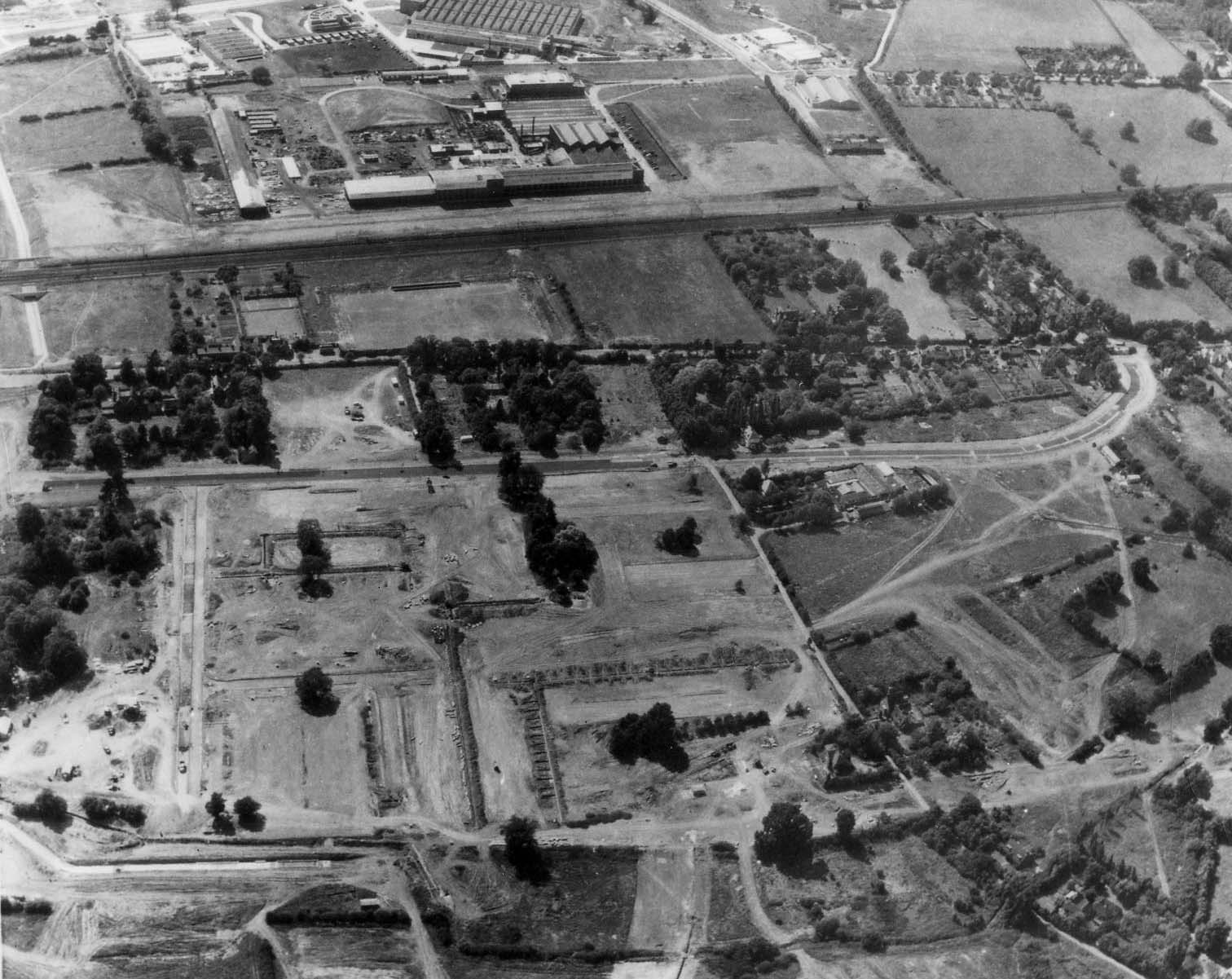
You are here: Home>Places>Aerial Views of Stevenage>Aerial view of the town centre site Aerial view of the town centre siteBy Pauline Maryan Aerial view of the town centre siteStevenage Museum P7461Can you recognise this layout of the town centre?This page was added on 03/02/2011. Add your comment about this pageYour email address will not be published. Required fields are marked *Your comment:Name * Email * Website Save my name, email, and website in this browser for the next time I comment.I consent to my name and e-mail address being stored along with this comment, and to the website editors communicating with me by e-mail about the comment if necessary. My name may be published alongside the comment on the website, but my e-mail address will not be published. My information will not be shared with any third party (see our Privacy Statement - opens in a new window). * Δ Replylove this old oneBy allan king (13/08/2017) ReplyComing down from top of picture, going from left to right (south to north!), GW King’s factory, railway, Great North Road (later Lytton Way), Danestrete, Town Square, then what would be Queensway. Picture taken from an easterly aspect, looking west.By Sue Bradford (14/05/2017) Aerial Views of StevenageAerial photo of the ESA factory at StevenageAerial view of British Aerospace in 1966Aerial view of Pin Green. 1955Aerial view of Stevenage 1958Aerial view of the Town Centre (late 1960s?)Aerial view of the Town Centre 1958Aerial view of the Town Centre 1986Aerial view of the town centre siteAerial view of the town centre site before building began, c. 1955Collenswood School From the AIrPin Green Water TowerStevenage From AboveStevenage Town Centre 1963The View from Brent Court in the Late 1960's See also'Aerial view of the town centre site' also appears inTown Centre Share thisFacebookPinterestTwitterLinkedin


Add your comment about this page
love this old one
Coming down from top of picture, going from left to right (south to north!), GW King’s factory, railway, Great North Road (later Lytton Way), Danestrete, Town Square, then what would be Queensway. Picture taken from an easterly aspect, looking west.