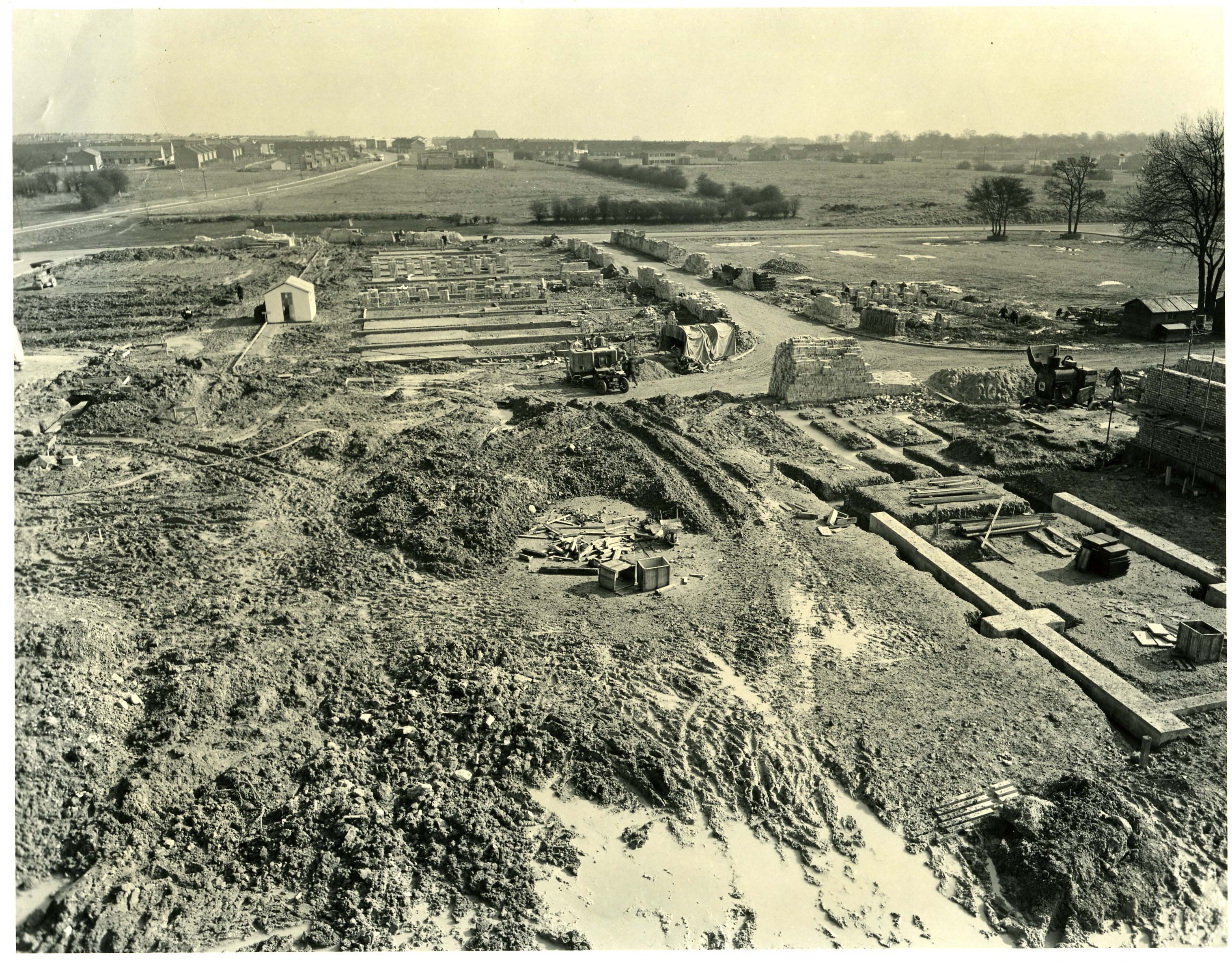
I think the road running from right to left is St Georges Way and the road with the small spur is Eastgate. The shed is in the middle of what is now the Market Place precinct (recently remodelled), while the road coming off St Georges Way at the extreme left is Market Square (at the back of where the TSB is now). The large tree on the extreme right, an ash I believe, was formerly in Blackamoors Lane (originally Broom Barns Lane) and has only been cut down in the last year or so (its stump is still there). The picture looks to have been taken from scaffolding put up for the construction of Block 7 roughly where the Co-op, now Primark, would be built or possibly the Brookfields newsagents/Heart Foundation shops, given the footings visible for the units in Market Place, starting with Frank Leslie’s shop on the south side and leading down to Creasey’s car showroom where the dentists is now.
looks like st Andrews church in the back ground. Broom Barns school, slightly to the right. Road on the left Cuttys lane. Fox road cutting left to right in the forground, Off to the right between the trees Walden end
Can anyone identify anything in this interesting photo? Would it be Six Hills Way running from right to left at the top of the picture – if so, Monkswood Way is the road at top left and we would be looking at the site of the tall flats (The Towers?) or maybe the site of the original police station?


Add your comment about this page
I think the road running from right to left is St Georges Way and the road with the small spur is Eastgate. The shed is in the middle of what is now the Market Place precinct (recently remodelled), while the road coming off St Georges Way at the extreme left is Market Square (at the back of where the TSB is now). The large tree on the extreme right, an ash I believe, was formerly in Blackamoors Lane (originally Broom Barns Lane) and has only been cut down in the last year or so (its stump is still there).
The picture looks to have been taken from scaffolding put up for the construction of Block 7 roughly where the Co-op, now Primark, would be built or possibly the Brookfields newsagents/Heart Foundation shops, given the footings visible for the units in Market Place, starting with Frank Leslie’s shop on the south side and leading down to Creasey’s car showroom where the dentists is now.
looks like st Andrews church in the back ground.
Broom Barns school, slightly to the right.
Road on the left Cuttys lane.
Fox road cutting left to right in the forground,
Off to the right between the trees Walden end
Can anyone identify anything in this interesting photo? Would it be Six Hills Way running from right to left at the top of the picture – if so, Monkswood Way is the road at top left and we would be looking at the site of the tall flats (The Towers?) or maybe the site of the original police station?